

Arizona National Scenic Trail
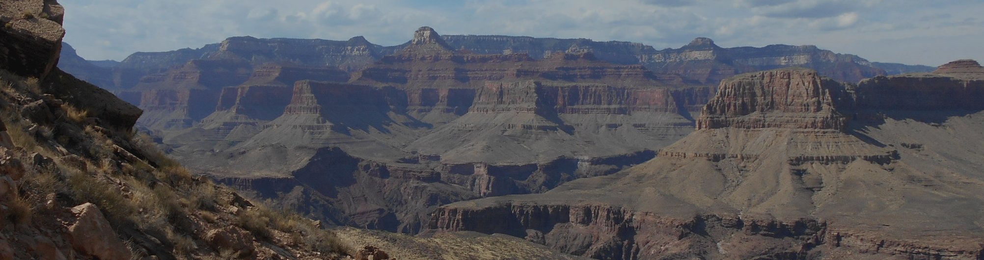
Arizona is a land of beauty and surprises! You hear about the Grand Canyon and the hot deserts, but many people don’t realize that Arizona also has lush forests, huge tracks of grasslands, snow-covered mountains and animals that look like something that came out of Central America. And, yes, the Grand Canyon is pretty darned awesome as well!
Even the notoriously hot deserts are filled with fascinating creatures and incredible wildflower blooms. Much of the state rises far above sea level providing some of the clearest skies for star gazing—it’s not a coincidence that Arizona hosts some of the world’s best observatories including Kitts Peak and the Lowell Observatory!
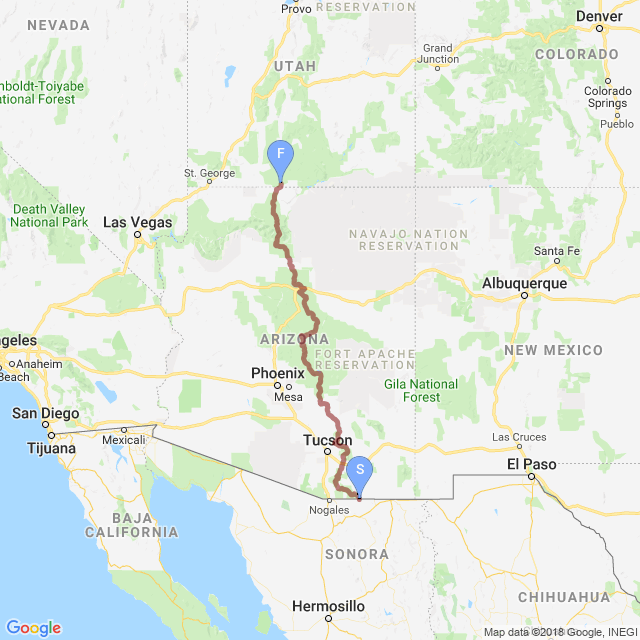
And the 800-mile (1,287 km) Arizona Trail runs right through the heart of it from the Mexican border to the Utah border. This footpath is the third national scenic trail to be completed (the other two are the Pacific Crest Trail and Appalachian Trail), and it links deserts, mountains, forests, canyons, lakes, mining claims, rivers and communities throughout the state. You’ll drop as low as 1,650 feet (500 m) above sea level along the Gila River to breath-taking heights of 9,600 feet (2,900 m) above sea level in the San Francisco Peaks.
In a word, Arizona is awesome! And the Arizona National Scenic Trail, or AZT for short, showcases the best of Arizona. It meanders through the Santa Catalina Mountains, over the Mogollon Rim, past the San Francisco Peaks and directly through the heart of the Grand Canyon. You’ll run into rattlesnakes and scorpions, but also rabbits, squirrels and elk.
The idea for the trail was originally developed and promoted in 1985 by Dale Shewalter, a Flagstaff fifth-grade school teacher. In 1988, the US Forest Service dedicated the first segment of the Arizona Trail—54 miles just north of the Grand Canyon. In 1994, the Arizona Trail Association formed as a non-profit to promote, build, maintain and protect the Arizona Trail. In 2011, the trail was officially completed linking the Mexican border to the Utah border. And in 2012, Congress officially designated the AZT as a national scenic trail.
The AZT on Walking 4 Fun
Our virtual walk will follow the trail northward from the Mexican border to the Utah border, which is the direction that mileages and guidebooks generally follow. The Arizona Trail Association divides the trail into passages, which more-or-less correspond to the stages found on Walking 4 Fun. In fact, the stage and passage numbers are identical up through stage/passage 32. The trail splits just before Flagstaff with a shorter resupply route running directly through Flagstaff while the main trunk of the Arizona Trail loops around town to the east. We’ll stay on the main trunk for our virtual walk.
Because of this split, our path skips passage 33 (the resupply route) and runs straight from passage 32 (stage 32) into passage 34 (stage 33). After that, the stage numbers will be one less than the corresponding passage number. Which isn’t really important to know for a virtual walk, but for those of you familiar with the passages and want to know why the stages don’t match up with passages after passage 32, that’s the reason.
You’ll also find another stage that has no corresponding passage at all—the very last one. The Arizona Trail ends at the Utah border, but it ends at the Vermilion Cliffs National Monument and a mere 30-minute walk away from Wire Pass Trailhead. This trailhead leads into the world-famous Coyote Buttes (home of the famous Wave formation) and Buckskin Gulch (the longest and deepest slot canyon in America). Seeing as we’re in the area, it would be a crime not to visit such a spectacular area! So the last stage continues a short ways into Utah to explore these Vermilion Cliffs a bit. We’ve come so far already—what’s another few miles between friends?
| Stage Name | Length (miles) | Position (miles) | |
|---|---|---|---|
| 1. | Huachuca Mountains | 21.3 | 0.0 → 21.3 |
| 2. | Canelo Hills: East | 14.5 | 21.3 → 35.8 |
| 3. | Canelo Hills: West | 16.5 | 35.8 → 52.3 |
| 4. | Temporal Gulch | 22.2 | 52.3 → 74.5 |
| 5. | Santa Rita Mountains | 13.3 | 74.5 → 87.8 |
| 6. | Las Colinas | 13.3 | 87.8 → 101.1 |
| 7. | Las Cienegas | 13.0 | 101.1 → 114.1 |
| 8. | Rincon Valley | 17.8 | 114.1 → 131.9 |
| 9. | Rincon Mountains | 21.6 | 131.9 → 153.5 |
| 10. | Redington Pass | 15.6 | 153.5 → 169.1 |
| 11. | Santa Catalina Mountains | 11.6 | 169.1 → 180.7 |
| 12. | Oracle Ridge | 22.4 | 180.7 → 203.1 |
| 13. | Oracle | 8.0 | 203.1 → 211.1 |
| 14. | Black Hills | 28.5 | 211.1 → 239.6 |
| 15. | Tortilla Montains | 28.3 | 239.6 → 267.9 |
| 16. | Gila River Canyons | 24.8 | 267.9 → 292.7 |
| 17. | Alamo Canyon | 11.5 | 292.7 → 304.2 |
| 18. | Reavis Canyon | 18.6 | 304.2 → 322.8 |
| 19. | Superstition Wilderness | 29.9 | 322.8 → 352.7 |
| 20. | Four Peaks | 19.3 | 352.7 → 372.0 |
| 21. | Pine Mountain | 19.8 | 372.0 → 391.8 |
| 22. | Saddle Mountain | 15.9 | 391.8 → 407.7 |
| 23. | Mazatzal Divide | 21.9 | 407.7 → 429.6 |
| 24. | Red Hills | 14.3 | 429.6 → 443.9 |
| 25. | Whiterock Mesa | 11.4 | 443.9 → 455.3 |
| 26. | Hardscrabble Mesa | 12.0 | 455.3 → 467.3 |
| 27. | Highline | 19.3 | 467.3 → 486.6 |
| 28. | Blue Ridge | 16.0 | 486.6 → 502.6 |
| 29. | Happy Jack | 30.7 | 502.6 → 533.3 |
| 30. | Mormon Lake | 34.3 | 533.3 → 567.6 |
| 31. | Walnut Canyon | 18.1 | 567.6 → 585.7 |
| 32. | Elden Mountain | 13.9 | 585.7 → 599.6 |
| 33. | San Francisco Peaks | 36.7 | 599.6 → 636.3 |
| 34. | Babbitt Ranch | 25.4 | 636.3 → 661.7 |
| 35. | Coconino Rim | 18.7 | 661.7 → 680.4 |
| 36. | Grand Canyon - South Rim | 23.4 | 680.4 → 703.8 |
| 37. | Grand Canyon - Inner Gorge | 20.9 | 703.8 → 724.7 |
| 38. | Grand Canyon - North Rim | 12.5 | 724.7 → 737.2 |
| 39. | Kaibab Plateau South | 21.5 | 737.2 → 758.7 |
| 40. | Kaibab Plateau Central | 17.3 | 758.7 → 776.0 |
| 41. | Kaibab Plateau North | 16.8 | 776.0 → 792.8 |
| 42. | Buckskin Mountain | 10.8 | 792.8 → 803.6 |
| 43. | Extra Credit: Vermilion Cliffs | 10.0 | 803.6 → 813.6 |