
Continental Divide Trail (CDT)
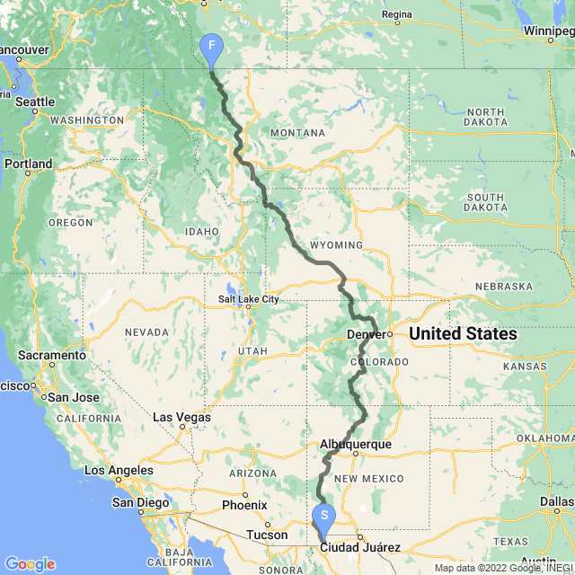
The Continental Divide Trail is meant to follow the Continental Divide through the United States between Mexico and Canada, or at least stay within 50 miles of it since it is not always practical to put the trail directly on the divide. The epic trail runs about 3,000 miles (4,800 km), but that is simply a rough estimate since there are so many alternates and detours that thru-hikers often take. Our route will take you a bit less.
The first sections of the trail were built in Colorado in 1962 and—at the time this virtual hike was created—is only about 70% completed. The rest are road walks connecting the completed sections.
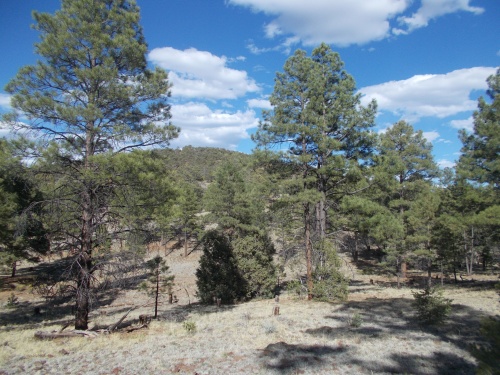
The trail runs through five states: New Mexico, Colorado, Wyoming, Idaho and Montana, and it includes some of the most scenic and dramatic scenery in the United States including three national parks (Rocky Mountains, Yellowstone and Glacier), and numerous other national monuments, wilderness areas and national forests. Wildlife varies from rattlesnakes to moose and bear, and you’ll see them all along this trail!
Interested in reading about the hike as I hiked it? Follow along on my blog at Another Long Walk—the CDT entries start on October 8, 2021.
Hikers who complete the Appalachian Trail, Pacific Crest Trail and the Continental Divide Trail are known as completing the Triple Crown of hiking, since the three trails cross the three major mountain ranges through the United States, and with this being the last of those three trails, you can now virtually complete a triple crown for yourself! It is quite the accomplishment, even a virtual version of it.
For this virtual hike, each actual day that I spent on the trail is its own stage. A stage may start or end at a major landmark such as a city, or it may start and end in the middle of nowhere. The length of the stage is based on the number of miles that I hiked in real life that day. You will find stages, on average, tend to be shorter during the first month on the trail since I have to build up my strength and stamina before I can pull 30-mile days. Over more challenging terrain, the day’s mileage might be smaller. I remember more than once in Colorado where I couldn’t even pull out a 20-mile day even though I had done them quite regularly before that—simply because the terrain was so difficult! But knowing each stage is an actual real-life day on the trail for me, you might notice that the photos at the beginning of a stage are typically in the mornings while the photos at the end of the stage are typically in the last afternoons. You can get a sense of where in the day you are based on how far through a stage you have walked.
And with all that out of the way.... check out the following preview of the Continental Divide Trail!
| Stage Name | Length (miles) | Position (miles) | |
|---|---|---|---|
| 1. | Mexican Border | 13.5 | 0.0 → 13.5 |
| 2. | Big Hatchet Mountains | 19.3 | 13.5 → 32.8 |
| 3. | Little Hatchet Mountains | 19.0 | 32.8 → 51.8 |
| 4. | Trail Angel Apple | 17.3 | 51.8 → 69.1 |
| 5. | Pyramid Peak | 17.8 | 69.1 → 86.8 |
| 6. | Lordsburg Arrival | 9.5 | 86.8 → 96.4 |
| 7. | Lordsburg Departure | 18.5 | 96.4 → 114.9 |
| 8. | Gold Hill | 16.6 | 114.9 → 131.5 |
| 9. | Burro Peak | 16.7 | 131.5 → 148.2 |
| 10. | Prescribed Burns Detour | 22.9 | 148.2 → 171.1 |
| 11. | Silver City Arrival | 10.0 | 171.1 → 181.1 |
| 12. | Silver City Departure | 15.0 | 181.1 → 196.1 |
| 13. | Gila Alternate Starts | 16.1 | 196.1 → 212.2 |
| 14. | Gila River Starts | 16.8 | 212.2 → 229.1 |
| 15. | Doc Campbell's Post | 15.2 | 229.1 → 244.3 |
| 16. | Gila Cliff Dwellings | 18.2 | 244.3 → 262.5 |
| 17. | Middle Fork of the Gila River | 20.6 | 262.5 → 283.0 |
| 18. | Snow Lake | 22.6 | 283.0 → 305.6 |
| 19. | Dutchman Spring | 20.0 | 305.6 → 325.6 |
| 20. | Wagontongue Mountain | 21.4 | 325.6 → 347.0 |
| 21. | Mangas Mountains | 21.8 | 347.0 → 368.8 |
| 22. | X-Country Range Walk | 20.1 | 368.8 → 388.9 |
| 23. | Pie Town Arrival | 10.6 | 388.9 → 399.5 |
| 24. | Pie Town Departure | 18.2 | 399.5 → 417.7 |
| 25. | West Malpais Wilderness Area | 25.7 | 417.7 → 443.4 |
| 26. | Chain-of-Craters | 23.4 | 443.4 → 466.8 |
| 27. | El Malpais National Monument | 23.7 | 466.8 → 490.5 |
| 28. | Bonita-Zuni Alternate | 22.6 | 490.5 → 513.1 |
| 29. | Grants Arrival | 11.6 | 513.1 → 524.6 |
| 30. | Grants Departure | 13.8 | 524.6 → 538.4 |
| 31. | Mount Taylor | 18.9 | 538.4 → 557.3 |
| 32. | Ojo de Dado | 20.3 | 557.3 → 577.6 |
| 33. | Cerro del Ojo Frio | 21.8 | 577.6 → 599.4 |
| 34. | Empedrado Wilderness Area | 19.6 | 599.4 → 619.1 |
| 35. | La Ventana Mesa | 18.5 | 619.1 → 637.5 |
| 36. | Cuba Arrival | 11.5 | 637.5 → 649.0 |
| 37. | Cuba Departure | 14.1 | 649.0 → 663.1 |
| 38. | San Pedro Peaks | 22.2 | 663.1 → 685.3 |
| 39. | Chama River | 20.3 | 685.3 → 705.6 |
| 40. | Mesa de Los Viejos | 23.7 | 705.6 → 729.3 |
| 41. | Upper Canjilon Lakes | 18.6 | 729.3 → 747.8 |
| 42. | Hopewell Lake Campground | 21.2 | 747.8 → 769.0 |
| 43. | Hopewell Lake | 18.0 | 769.0 → 787.0 |
| 44. | Brazos Ridge HP | 19.7 | 787.0 → 806.7 |
| 45. | New Mexico-Colorado Border | 10.4 | 806.7 → 817.1 |
| 46. | Chama Departure | 14.0 | 817.1 → 831.1 |
| 47. | South San Juans | 20.8 | 831.1 → 851.9 |
| 48. | Snowpocalypse! | 15.2 | 851.9 → 867.1 |
| 49. | Great Divide Alternate | 25.4 | 867.1 → 892.5 |
| 50. | Pagosa Springs Arrival | 18.8 | 892.5 → 911.3 |
| 51. | Pagosa Springs Departure | 14.9 | 911.3 → 926.2 |
| 52. | Creede Cutoff South | 21.8 | 926.2 → 948.0 |
| 53. | Creede Cutoff North | 21.0 | 948.0 → 969.0 |
| 54. | Eddiesville | 26.4 | 969.0 → 995.3 |
| 55. | Buffalo Pass | 15.5 | 995.3 → 1,010.8 |
| 56. | Sargents Mesa | 21.6 | 1,010.8 → 1,032.4 |
| 57. | Salida Arrival | 27.0 | 1,032.4 → 1,059.4 |
| 58. | Salida Departure | 21.4 | 1,059.4 → 1,080.7 |
| 59. | Mirror Lake Alternate | 18.6 | 1,080.7 → 1,099.3 |
| 60. | Lake Ann | 24.1 | 1,099.3 → 1,123.5 |
| 61. | Leadville Arrival | 19.2 | 1,123.5 → 1,142.7 |
| 62. | Leadville Departure | 10.2 | 1,142.7 → 1,152.9 |
| 63. | Mount Massive | 22.9 | 1,152.9 → 1,175.8 |
| 64. | Camp Hale | 22.1 | 1,175.8 → 1,198.0 |
| 65. | Copper Mountain | 14.6 | 1,198.0 → 1,212.5 |
| 66. | Frisco and Dillon | 15.0 | 1,212.5 → 1,227.5 |
| 67. | Silverthorne Alternate | 14.0 | 1,227.5 → 1,241.4 |
| 68. | Vasquez Peak Wilderness | 19.2 | 1,241.4 → 1,260.6 |
| 69. | Berthoud Pass | 17.4 | 1,260.6 → 1,278.1 |
| 70. | James Peak | 19.8 | 1,278.1 → 1,297.8 |
| 71. | Lake Granby | 20.5 | 1,297.8 → 1,318.3 |
| 72. | Grand Lake | 15.1 | 1,318.3 → 1,333.4 |
| 73. | Rocky Mountains NP | 21.8 | 1,333.4 → 1,355.2 |
| 74. | Parkview Mountain | 6.2 | 1,355.2 → 1,361.4 |
| 75. | Haystack Mountain | 17.0 | 1,361.4 → 1,378.4 |
| 76. | Arapaho Creek Watershed | 31.8 | 1,378.4 → 1,410.2 |
| 77. | Steamboat Springs Arrival | 21.6 | 1,410.2 → 1,431.8 |
| 78. | Steamboat Springs Departure | 19.5 | 1,431.8 → 1,451.4 |
| 79. | Hahns Peak | 26.1 | 1,451.4 → 1,477.5 |
| 80. | Colorado-Wyoming Border | 23.1 | 1,477.5 → 1,500.6 |
| 81. | Bridger Peak | 26.5 | 1,500.6 → 1,527.1 |
| 82. | Divide Peak | 27.5 | 1,527.1 → 1,554.6 |
| 83. | Muddy Creek | 28.0 | 1,554.6 → 1,582.6 |
| 84. | Rawlins Arrival | 14.8 | 1,582.6 → 1,597.5 |
| 85. | Rawlins Departure | 25.2 | 1,597.5 → 1,622.7 |
| 86. | Middle of Nowhere | 28.3 | 1,622.7 → 1,651.0 |
| 87. | Crooks Peak | 27.8 | 1,651.0 → 1,678.8 |
| 88. | Oregon Trail | 29.7 | 1,678.8 → 1,708.5 |
| 89. | South Pass City | 22.1 | 1,708.5 → 1,730.6 |
| 90. | Sweetwater Watershed | 22.0 | 1,730.6 → 1,752.7 |
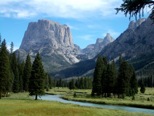
| 91. | Cirque of the Towers | 19.6 | 1,752.7 → 1,772.2 |
| 92. | Sandpoint Lake | 18.5 | 1,772.2 → 1,790.7 |
| 93. | Hat Pass | 23.0 | 1,790.7 → 1,813.7 |
| 94. | Pinedale Arrival | 8.3 | 1,813.7 → 1,822.1 |
| 95. | Pinedale Departure | 16.2 | 1,822.1 → 1,838.3 |
| 96. | Green River | 22.9 | 1,838.3 → 1,861.2 |
| 97. | Lake of the Woods | 22.6 | 1,861.2 → 1,883.8 |
| 98. | Leeds Creek Alternate | 26.5 | 1,883.8 → 1,910.4 |
| 99. | Dubois Arrival | 11.5 | 1,910.4 → 1,921.9 |
| 100. | Dubois Departure | 16.3 | 1,921.9 → 1,938.2 |
| 101. | Buffalo Creek | 21.4 | 1,938.2 → 1,959.6 |
| 102. | Parting of the Waters | 19.6 | 1,959.6 → 1,979.2 |
| 103. | Snake River | 13.3 | 1,979.2 → 1,992.6 |
| 104. | Heart Lake | 23.9 | 1,992.6 → 2,016.5 |
| 105. | Old Faithful Village | 21.0 | 2,016.5 → 2,037.5 |
| 106. | Biscuit Basin | 9.6 | 2,037.5 → 2,047.1 |
| 107. | Wyoming-Idaho Border | 19.4 | 2,047.1 → 2,066.5 |
| 108. | Idaho-Montana Border | 20.4 | 2,066.5 → 2,086.9 |
| 109. | West Yellowstone Departure | 17.5 | 2,086.9 → 2,104.4 |
| 110. | Lee Metcalf Wilderness | 25.4 | 2,104.4 → 2,129.8 |
| 111. | Taylor Creek | 15.4 | 2,129.8 → 2,145.2 |
| 112. | Sphinx Mountain | 23.0 | 2,145.2 → 2,168.2 |
| 113. | Ennis Arrival | 28.6 | 2,168.2 → 2,196.9 |
| 114. | Harrison Arrival | 28.1 | 2,196.9 → 2,224.9 |
| 115. | Lewis & Clark Caverns | 24.4 | 2,224.9 → 2,249.4 |
| 116. | Whitehall Arrival | 16.3 | 2,249.4 → 2,265.7 |
| 117. | Whitehall Departure | 22.8 | 2,265.7 → 2,288.5 |
| 118. | Nez Perce Trail | 23.2 | 2,288.5 → 2,311.8 |
| 119. | Champion Pass | 23.8 | 2,311.8 → 2,335.5 |
| 120. | Thunderbolt Mountain | 24.9 | 2,335.5 → 2,360.4 |
| 121. | Helena Arrival | 10.6 | 2,360.4 → 2,371.0 |
| 122. | Helena Departure | 21.5 | 2,371.0 → 2,392.5 |
| 123. | Stemple Pass | 21.9 | 2,392.5 → 2,414.4 |
| 124. | Flesher Pass | 23.5 | 2,414.4 → 2,437.9 |
| 125. | Rogers Pass | 19.0 | 2,437.9 → 2,456.8 |
| 126. | Dearborn River | 21.1 | 2,456.8 → 2,477.9 |
| 127. | Augusta Arrival | 20.7 | 2,477.9 → 2,498.6 |
| 128. | Augusta Departure | 14.3 | 2,498.6 → 2,512.9 |
| 129. | Chinese Wall | 22.6 | 2,512.9 → 2,535.5 |
| 130. | Spotted Bear Alternate | 16.4 | 2,535.5 → 2,551.9 |
| 131. | Strawberry Creek | 22.6 | 2,551.9 → 2,574.4 |
| 132. | Trapper Gulch Alternate | 22.1 | 2,574.4 → 2,596.5 |
| 133. | East Glacier Arrival | 25.9 | 2,596.5 → 2,622.4 |
| 134. | Two Medicine Arrival | 12.2 | 2,622.4 → 2,634.7 |
| 135. | Two Medicine Departure | 13.7 | 2,634.7 → 2,648.4 |
| 136. | Triple Divide Pass | 16.0 | 2,648.4 → 2,664.4 |
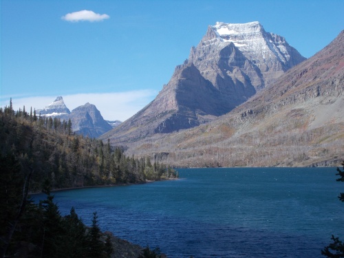
| 137. | Saint Mary Lake | 15.6 | 2,664.4 → 2,680.0 |
| 138. | Ptarmigan Tunnel | 26.9 | 2,680.0 → 2,706.9 |
| 139. | Canadian Border | 11.1 | 2,706.9 → 2,718.0 |
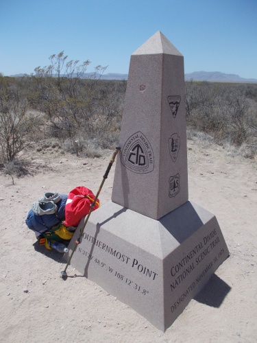
Southern terminus monument
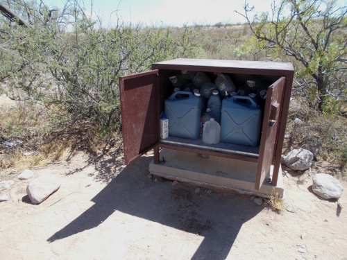
Water cache!
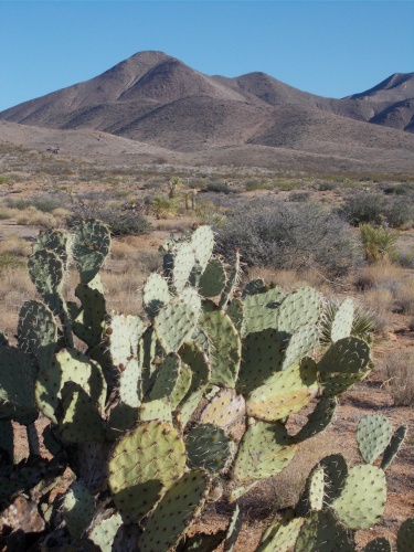
Prickly Pear Cactus
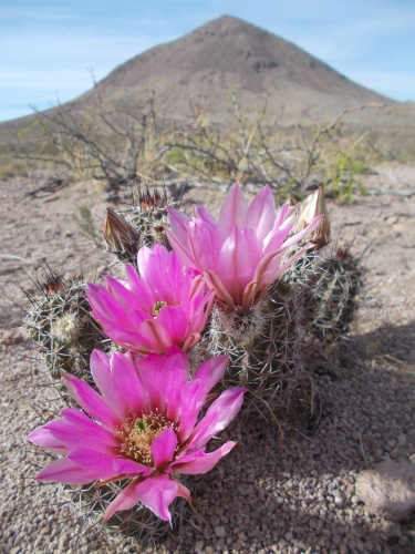
Flowers of the desert
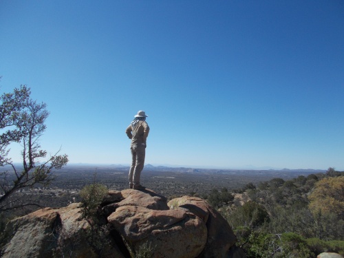
Green Tortuga admires the view

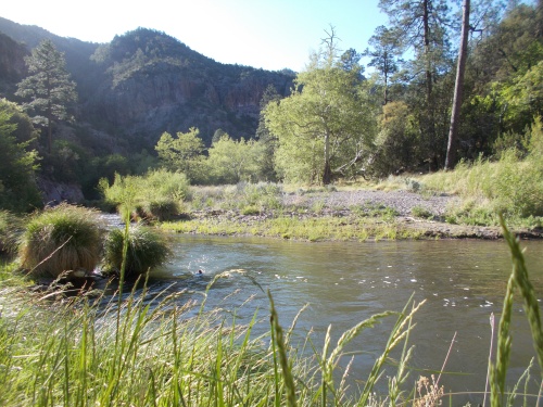
Gila River
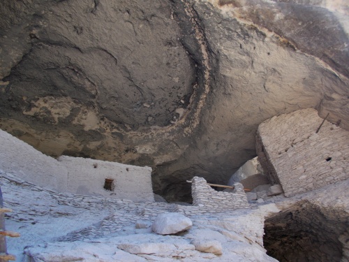
Gila Cliff Dwellings
Cerro Negro

Iris
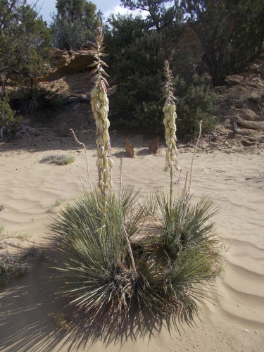
Yucca plant
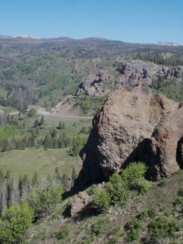
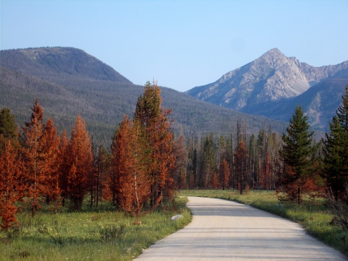
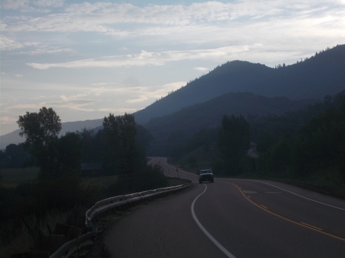
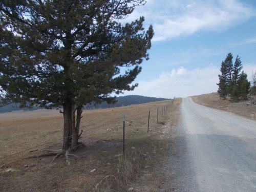
Cumbres Pass
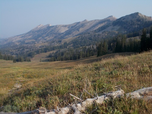
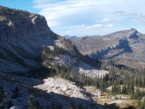
View from Kokomo Pass
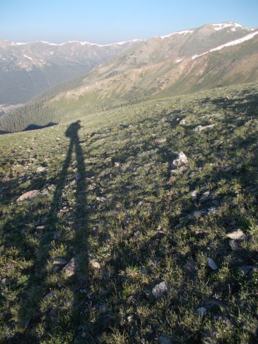
Long shadows....
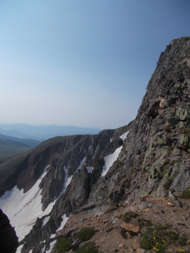
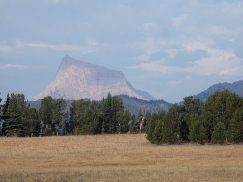
James Peak
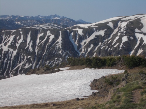
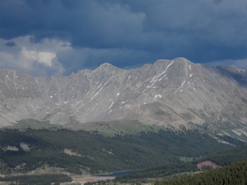
Rocky Mountain NP
View from Parkview Mountain
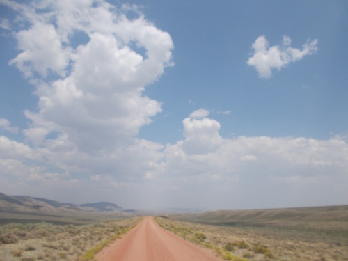
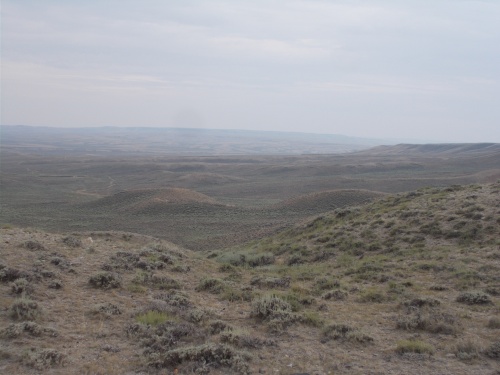
Great Divide Basin
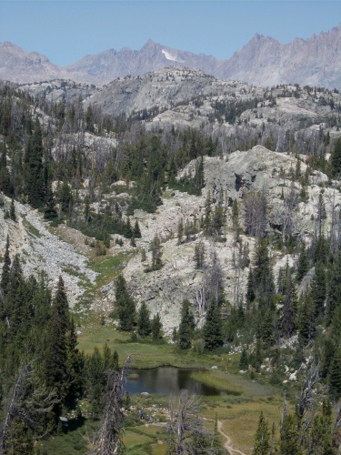
Little Sandy Lake
Green River
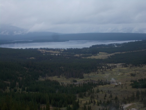
Heart Lake
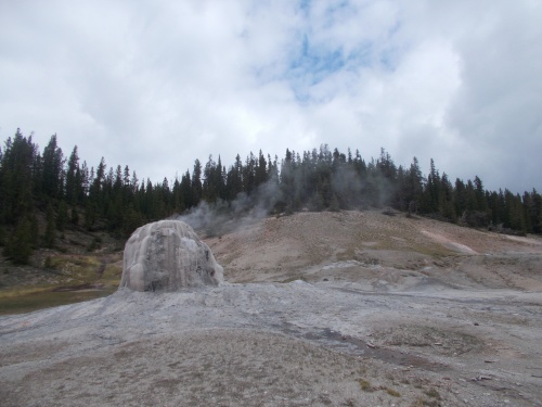
Lone Star Geyser
Sphinx Mountain
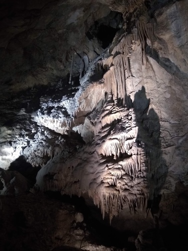
Lewis & Clark Caverns
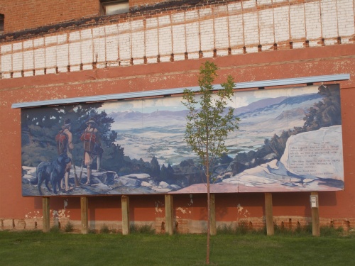
Lewis and Clark Mural
Chinese Wall
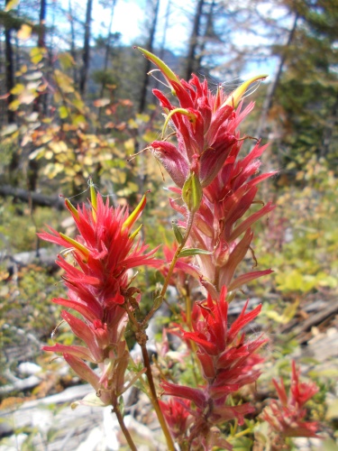
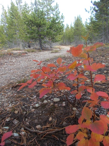
Indian paintbrush
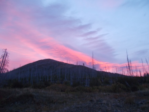
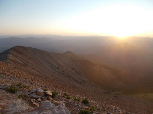
Sunrise!
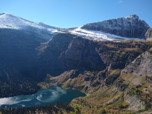
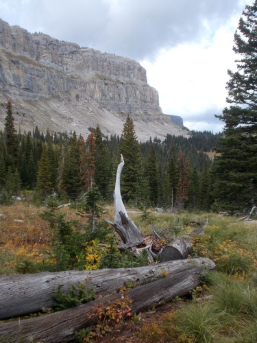
Medicine Grizzly Lake
St. Mary's Lake